Tracked shipping to South Africa with premium packaging for just R199 

Ship to
South Africa
0
  • argentina
  • chile
  • colombia
  • españa
  • méxico
  • perú
  • estados unidos
  • internacional

Select your country

Americas

Europe

Rest of the world

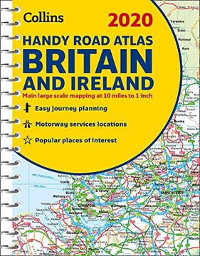
portada 2020 Collins Handy Road Atlas Britain and Ireland
Type
Physical Book
Publisher
Year
2019
Language
English
Pages
80
Format
Spiral Format
Dimensions
20.8 x 15.5 x 0.3 cm
Weight
0.09 kg.
ISBN13
9780008318710

2020 Collins Handy Road Atlas Britain and Ireland

Collins Maps (Author) · Collins · Spiral Format

2020 Collins Handy Road Atlas Britain and Ireland - Collins Maps

New Book Imported to South Africa
Delivery: 18 Aug - 27 Aug Shipping: 12 to 14 business days.
R 248
R 248

Synopsis "2020 Collins Handy Road Atlas Britain and Ireland "

This easy-to-use, handy A5 sized road atlas with popular lie-flat spiral binding features extremely clear route planning maps of Britain and Ireland and fits neatly into your glove compartment, briefcase or bag. The atlas has been fully updated for 2020. The maps of Britain are at 9.9 miles to 1 inch (1:625,000) and the whole of Ireland is covered at 15.8 miles to 1 inch (1:1,000,000). There are also a selection of more detailed urban area maps at 4.5 miles to 1 inch (1:285,000) to aid route planning in these busy areas. Includes road maps that focus on the main roads, motorways and settlements; more detailed maps of London, Manchester, Merseyside and West Midlands; Park & Ride locations (for bus and rail); and handy distance calculator chart highlighting distances between the major towns.

Customers reviews

Frequently Asked Questions about the Book

All books in our catalog are Original.
The book is written in English.
The binding of this edition is Spiral Format.

Questions and Answers about the Book

Do you have a question about the book? Login to be able to add your own question.

Opinions about Bookdelivery

More customer reviews