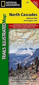
- Waterproof - Tear-Resistant - Topographic MapExplore the alpine forests, wild rivers, jagged peaks, and abundant glaciers of North Cascades National Park with National Geographic's Trails Illustrated map. Expertly researched and created in partnership with local land management agencies, this map features key points of interest including Baker Lake; Rockport State Park; Chelan and Ross Lake National Recreation Areas; Stephen Mather, Mount Baker, and Pasayten Wilderness Areas; Snoqualmie and Okanogan Wenatchee National Forests; and portions of the Sauk, Skagit, and Suiattle rivers. With miles of clearly marked trails including the popular Pacific Crest and Pacific Northwest trails, this map can guide you off the beaten path and back again. Mileages between intersections are shown and the map base includes contour lines and elevations for summits. Helpful material about backcountry use, regulations, recreation activities, and agency contact information will assist you in making the most of your visit. Recreation features noted include alpine ski areas, rental cabins, lookout towers, campgrounds, interpretive trails, boat launches, fishing access, and more.Every Trails Illustrated map is printed on "Backcountry Tough" waterproof, tear-resistant paper. A full UTM grid is printed on the map to aid with GPS navigation.Other features found on this map include: Bacon Peak, Baker Lake, Bonanza Peak, Glacier Peak Wilderness, Hidden Lake Peaks, Lake Chelan-Sawtooth Wilderness, Lake Shannon, Miners Ridge, Mount Baker, Mount Baker Wilderness, Mount Buckindy, Mount Challenger, Mount Lago, Mount Logan, Mount Shuksan, Mount Spickard, Mt. Baker National Forest, Noisy-Diobsud Wilderness, North Cascades, Okanogan National Forest, Pasayten Wilderness, Picket Range, Ross Lake, Sauk River, Snowking Mountain, Suiattle River, Twin Sisters Mountain, Wenatchee National Forest.Map Scale = 1:100,000Sheet Size = 25.5" x 37.75"Folded Size = 4.25" x 9.25"