Tracked shipping to South Africa with premium packaging for just R199 

Ship to
South Africa
0
  • argentina
  • chile
  • colombia
  • españa
  • méxico
  • perú
  • estados unidos
  • internacional

Select your country

Americas

Europe

Rest of the world

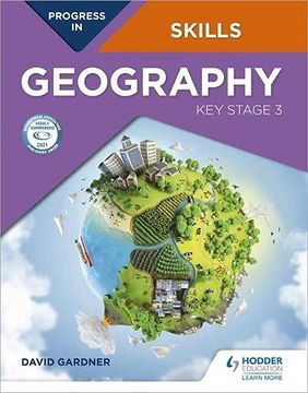
portada Progress in Geography Skills: Key Stage 3 (Progress in Skills)
Type
Physical Book
Year
2020
Language
English
Pages
136
Format
Paperback
ISBN13
9781510477575

Progress in Geography Skills: Key Stage 3 (Progress in Skills)

David Gardner (Author) · Hodder Education · Paperback

Progress in Geography Skills: Key Stage 3 (Progress in Skills) - David Gardner

New Book Imported to South Africa
Delivery: 12 Oct - 20 Oct Shipping: 2 to 3 business days.
R 557
R 557

Synopsis "Progress in Geography Skills: Key Stage 3 (Progress in Skills) "

This book is designed to help students build up and apply geographical skills throughout KS3. A wide range of skills are introduced in Unit 1, and then revisited and progressed in different contexts in Units 2-15 as part of a learning journey to becoming a geographer. These skills are progressed as an integral component of an enquiry process. The book provides a firm foundation for the geographical skills required at GCSE level and beyond. A wide range of geographical data is provided including satellite images and a large number of OS maps at a variety of scales, often linked to other data, such as ground and aerial photos. Progress in Geography Skills: Key Stage 3 can be used independently or alongside the Progress in Geography: Key Stage 3 Student book.Each page has a specific learning objective and skills focus, such as:- Conducting geographical enquiries; considering different points of view and making decisions - Drawing field sketches, linked to OS maps and locating places using lines of latitude and longitude on an atlas or grid references on OS maps- Understanding and drawing a wide variety of graphs- Analysis and presentation of statistical data- Comparing ground level photographs with Ordnance Survey maps and being able to identify coastal, glacial and river landforms on OS maps- Using newspapers to investigate issues, and detect bias- Using websites, including online GiS, as part of enquiries and investigating data

Customers reviews

Frequently Asked Questions about the Book

All books in our catalog are Original.
The book is written in English.
The binding of this edition is Paperback.

Questions and Answers about the Book

Do you have a question about the book? Login to be able to add your own question.

Opinions about Bookdelivery

More customer reviews