Tracked shipping to South Africa with premium packaging for just R199 

Ship to
South Africa
0
  • argentina
  • chile
  • colombia
  • españa
  • méxico
  • perú
  • estados unidos
  • internacional

Select your country

Americas

Europe

Rest of the world

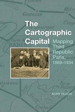
portada The Cartographic Capital: Mapping Third Republic Paris, 1889-1934
Type
Physical Book
Year
2021
Language
English
Pages
320
Format
Paperback
ISBN13
9781800855854

The Cartographic Capital: Mapping Third Republic Paris, 1889-1934

Kory Olson (Author) · Liverpool University Press · Paperback

The Cartographic Capital: Mapping Third Republic Paris, 1889-1934 - Olson, Kory

New Book Imported to South Africa
Delivery: 23 Dec - 04 Jan Shipping: 14 to 15 business days.
R 1,090
R 1,090

Synopsis "The Cartographic Capital: Mapping Third Republic Paris, 1889-1934"

Through official maps, this book looks at how government presentations of Paris and environs change over the course of the Third Republic (1889-1934). Governmental policies, such as the creation of a mandatory national uniform educational system that will eventually include geography, combined with technological advances in the printing industry, to alter the look, exposure, reception, and distribution of government maps. The government initially seemed to privilege an exclusively positive view of the capital city and limited its presentation of it to land inside the walled fortifications. However, as the Republic progressed and Paris grew, technology altered how Parisians used and understood their urban space. Rail and automobiles made moving about the city and environs easier while increased industrialization moved factories and their workers further out into the Seine Department. During this time, maps transitioned from reflecting the past to documenting the present. With the advent of French urbanism after World War I, official mapped views of greater Paris abandoned privileging past achievements and began to mirror actual residential and industrial development as it pushed further out from the city centre. Finally, the government needed to plan for the future of greater Paris and official maps begin to show how the government viewed the direction of its capital city.

Customers reviews

Frequently Asked Questions about the Book

All books in our catalog are Original.
The book is written in English.
The binding of this edition is Paperback.

Questions and Answers about the Book

Do you have a question about the book? Login to be able to add your own question.

Opinions about Bookdelivery

More customer reviews